Have you hiked on the Arizona Trail? If not you might be surprised to learn that there are great opportunities to experience a day hike on the AZT that are only a short drive from Tucson! One of my favorite sections of the AZT is the Sycamore Reservoir Trail.
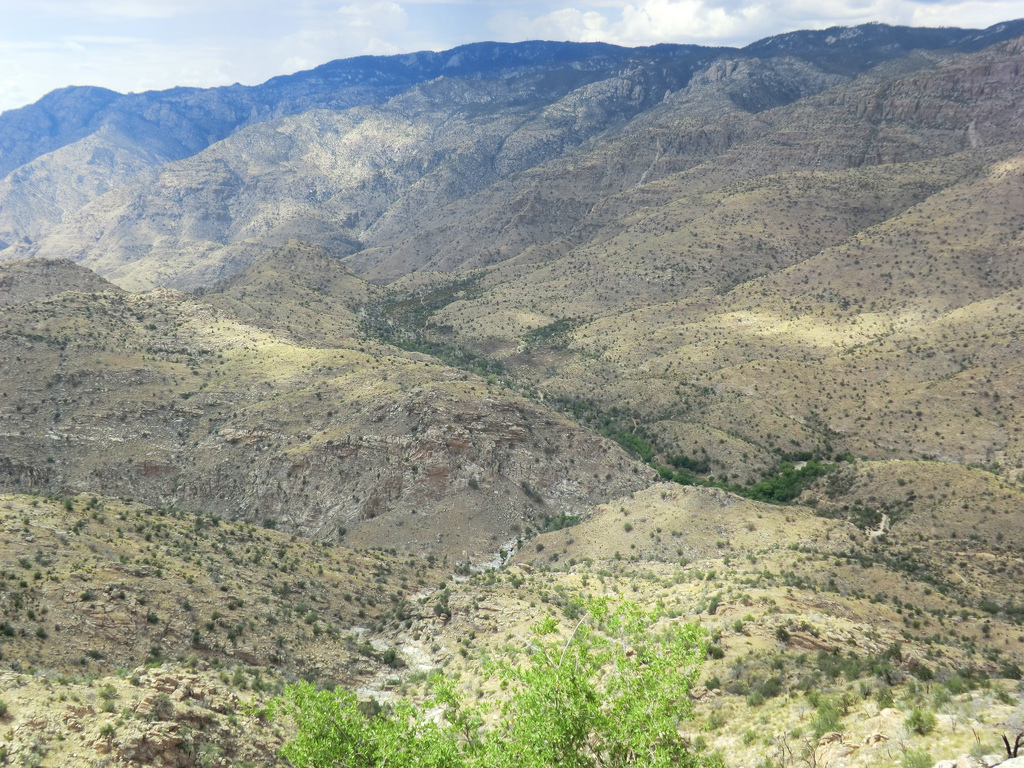
Looking down into the Sycamore Reservoir area – the stripe of green marks Sycamore Canyon with the most prominent green area marking the Sycamore Dam and Reservoir.
This hike starts from the Gordon Hirabayashi Recreation Site just over 7 miles up the General Hitchcock Highway. The Recreation Site is named for Dr. Gordon Hirabayashi who was imprisoned during WW II for resisting the relocation and internment Japanese Americans – a conviction that was overturned by the Supreme Court in 1987. A sidewalk between two foot bridges near the entrance will take you past a several signs with information about the history of the area.
After turning into the Gordon Hirabayashi Recreation Site take the dirt road past the campsites and restrooms to one of the parking areas near the corrals. The trail begins from the south side of the parking lot – a sign near the beginning of the trail shows the surrounding area and trails – standing in front of the sign you are on the Molino Basin Trail and the Arizona Trail! Follow the trail to the right and down the hill to a signed junction with Soldier Trail – the Molino Basin Trail continues to the right. At just over a mile you will arrive at Shreve Saddle – at the saddle the trail becomes the Sycamore Reservoir Trail and you enter the Pusch Ridge Wilderness.

Shreve Saddle – Arizona Trail sign and gate blocking access to an old road. Beyond this point you are in the Pusch Ridge Wilderness
From the saddle the trail heads steadily downhill – note the junction at 2 miles (it can be slightly confusing on the way back…). At 2.2 miles there is a sign and trail leading off to the left – the trail to the left is an unofficial route that will take you on a short side trip to the dam that was constructed to create Sycamore Reservoir. The reservoir was created to provide water for the Prison Camp – the dam traps water from both Sycamore Canyon and Bear Canyon. While it I don’t think anyone would currently describe the area behind the dam as a reservoir the dam does, at times, provide water for an impressive seasonal display of green! Of course, use caution around the old dam.


The dam is hidden by the trees – while the hillside is often green note the change in the right side of the picture form September of 2011 (Green!) and December 2012…
After returning to the main trail you will soon cross Bear Canyon and then notice Sycamore Canyon on your left. At 3.1 miles a large cairn on the left marks the junction with the Bear Canyon Shortcut trail (useful if you are heading to Thimble Peak). At 3.5 miles the trail reaches its end at a junction with the East Fork Trail (the AZT continues down into the Sabino Canyon area – see Dave Baker’s AZT entry from this area in 2008) and the Bear Canyon Trail (which will take you to Seven Falls). From this junction there are great views – look carefully and you will see the Palisade Trail winding down to its junction with the East Fork Trail! There are quite a few hiking options from this junction – but one of the simplest is to return the way you came.


The author with Sycamore Dam in the background – be very cautious if you decide to go off trail and scramble to the base of the dam – steep cliffs, loose rock and slippery footing…
Season: Fall, winter and spring.
Water: There is often water near the dam and sometimes in both Bear and Sycamore Canyons. Purify before drinking. As always, it is best to bring plenty of your own.
Difficulty: The hike to the junction with the Bear Canyon Trail and East Fork Trail is just under 7 miles (round trip) with close to 1,000 feet of total elevation gain – moderately difficulty.
Maps: Green Trails Recreation Map – Santa Catalina Mountains.
