{Written by Summit Hut Gearhead Doug and Lauren James }
Introduction
Santa Catalina Island is a rocky little island off the coast of Southern California. It’s about 75 square miles in total. You can get there via ferry from several ports in the San Diego or Los Angeles area. Most of the island is part of the Catalina Island Conservancy, which means that it cannot be developed and is left in its beautiful, wild state. This makes it an ideal hiking destination, especially for those who want to surround themselves with nature, but still be a phone call away from help if it is needed!
The Trans Catalina trail is about 40 miles total. Most people split the hike into 5 days. We decided to do it in four (January 25-28), and it was tough but doable. You get a hiking permit automatically with your campground reservations. You can book your campgrounds online, but you might also consider calling to make your reservations. The folks at the Catalina Island Visitors Services are excellent at their job and super friendly. I know this because we rescheduled this trip three times before we were finally able to do it, and these folks were very helpful with the process, and had some good tips and tricks that I wouldn’t have known about by just booking online (such as which campsites are the best, and what days the ferry runs).

Gear
Packs: Atmos/Aura AG LT 65L
We selected these packs because of their super comfy hip belts. It can carry heavy loads when needed. Doug loves the airy back. Lauren loves that it has just the right amount of pockets.
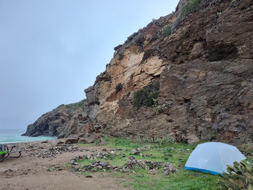
Shelter: Mountain Hardwear Aspect 3
This tent easily fits two wide pads. It has two doors and two vestibules, and is made with ultralight siliconized nylon. Lauren loved that she could get out of the tent to pee in the middle of the night without climbing over Doug. Doug loves how roomy it is, and the fact that it’s freestanding, has DAC aluminum poles, and is so lightweight.
Sleeping Bags and Pads
Doug – Outdoor Vitals Stormloft 15 degree quilt with a Nemo Tensor Extreme Conditions pad
Lauren – Nemo Disco 15 degree sleeping bag with a Big Agnes Q-Core Deluxe pad
Cook System and Food
Jetboil Flash, GSI insulated backpacker mugs, GSI long spoons. For breakfast we usually had Kodiak protein-packed oatmeal. For lunch we would snack. For dinners we adore the pre-made dehydrated backpackers meals. The Jetboil makes it easy to whip up a quick, hot meal with no fuss and little cleanup.
Clothing and Shoes
Doug – Sun hoodie shirt, Prana Stretch Zion pants, Sax boxer briefs, Darn Tough medium weight hiking socks, Loa Camino GTX boots, Kuhl ballcap, Mountain Hardwear Kor Airshell Warm Hooded Jacket, Marmot Warm Cube Jacket, Mountain Hardwear Stretch Ozonic Jacket
Lauren – Patagonia sun hoodie shirt, Prana BoSung pants (I wear these daily for work too!), MeUndies underwear, Darn Touch medium weight hiking socks, La Sportiva Ultra Raptor 2, Mountain Hardwear Kor Airshell Warm Hooded Jacket, 650 FP Down Jacket, Mountain Hardwear Stretch Ozonic Jacket
Miscellaneous
Trekking poles – LEKI Super Makalu
Chairs – Helinox Chair 1 (these were not strictly needed – they had picnic tables both along the trail and at the campsite – but having a chair with back support after a long day of hiking is amazing!)
Water Containers – 1 liter Smart Water bottles (3 each)
Headlamps – Petzl Actik Core
Creature Comforts – Lauren always brings a P-Style and a Culoclean on backpacking trips!
Apps – We had the trails downloaded on the Alltrails app (which is good because Lauren’s phone had no reception, and Doug’s phone had very little!)
Day 1: That’s a Gnarly Trail!

After getting off the ferry at Two Harbors around noon, we grabbed a few snacks at the convenience store in town. The store clerk asked where we were headed, and we said that we were taking the Silver Peak Trail to Parson’s Landing. (There are two ways to get to Parson’s Landing: the 6.7 mile Silver Peak Trail, or the 7.7 mile walk along West End Road.) He raised his eyebrows in delight and replied “Oh yeah, get some!” and that he hoped the mud had dried enough for us. On our walk through town, a guy in a van stopped us and asked if we needed directions. After explaining that we were headed to the trailhead, he replied, “That’s a gnarly trail, man. You sure you don’t want to take the road? It’s flat and easy.” We reassured him that we did indeed want to hike the trail, whereupon he said again that the trail was “gnarly.”


The trail was indeed gnarly. The first 3+ miles, you climb 1800 feet in elevation with little reprieve, and then climb back down that 1800 feet for the second 3+ miles to get to the scenic beach of Parson’s Landing. Many cite this trek as the most difficult leg of the Trans Catalina trail, and we decided to do it on the first day, with a full pack of food. Perhaps not optimal. 1800 feet elevation gain doesn’t sound too bad, until you realize that whoever designed these trails did not believe in switchbacks. Instead, the trail designer seemed to especially enjoy following ridgelines, hitting every peak possible along the route. We won’t say that the Trans Catalina Trail hits every peak, but it certainly makes an effort!

The challenging hike was worth it though. We were greeted by glittering surf, a few curious foxes, some lockers with firewood and water, and a clean vault toilet. Each campground has its own picnic table and bear box. To top it off, we were the only campers in the entire campground that night – a rarity even in the off season. Our new tent was easy to set up and performed admirably. Falling asleep to the sound of the waves, with the stars glittering overhead – it was magical.


Day 2: There Will Be Mud
This day was our most difficult day, as it combined two legs that most hikers separate into two days. The first leg wasn’t too bad – a 7.7 mile walk along the aforementioned West End Road.
While not as isolated as the Silver Peak Trail, it was still a fun hike. We walked past a bunch of campgrounds – some glitzy and some dilapidated. And, best of all, we spent the morning enjoying sweeping ocean views.

At Two Harbors, we stopped and got lunch. The Harbor Reef Restaurant was closed for remodeling when we were there, but the convenience store has a wide selection of food and also provides a microwave, plates, and utensils for hikers who want a hot meal.
We ran into some hikers who were headed to Parson’s Landing that evening. They warned us about sticky mud on our next leg – a hike of about 5 miles with 1200 feet of elevation gain. They were not exaggerating. There was a stretch of sticky mud that felt like it was going to swallow us up! We sometimes hiked at the side of the trail to avoid slipping and falling. Fortunately the mud was mostly in the first mile or two, and after that we were treated to some amazing views that made the whole thing worth the trouble. We also enjoyed having the whole afternoon to ourselves; we didn’t see a single other person on the trail. Still, this was quite a challenging 5 miles for us, and we ended up reaching the campsite after dark.


When we were about a mile from our destination, we stopped to check the AllTrails app to see how much further we had to go. It was at that point we heard a strange snuffling noise. We looked up and saw a faint large dark outline standing right in the middle of the trail. It was a huge bison – and he wasn’t going anywhere. It was unnerving to know that if we hadn’t stopped to check our map, we might have ran right into this guy! We bushwhacked in a wide arc around him to avoid any conflict.

We were so glad to get to Little Harbor after such a grueling day! We were glad we’d ordered some firewood. We sat in our camping chairs around the warm fire, ate hot food, and relaxed for a bit. It seemed fitting that our dinner for that night was Unstuffed Pepper by Bushka’s Kitchen, which includes ground bison meat!

