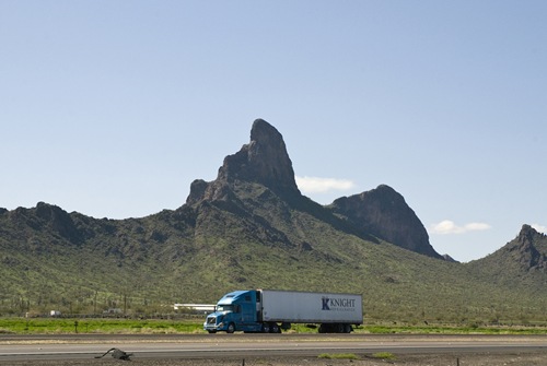
Picacho Peak is many things to many people. It has been a traveler’s landmark for thousands of years; Don Juan Bautista de Anza traveled past the peak during his trip through the area in 1775. Arizona’s one and only Civil War battle occurred around Picacho, and an annual reenactment of the skirmish is very popular. Thousands visit Picacho in favorable years to witness one of southern Arizona’s most accessible and magnificent spring wildflower blooms. Many visitors stop to ponder an ostrich ranch located near the base of the peak.

Picacho Peak
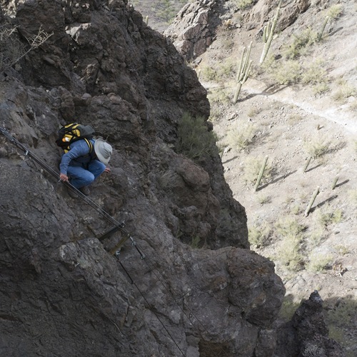
And then there is hiking. Three trails around the base of the peak join together on the south side of the summit tower and follow steel cables and catwalks through weaknesses among steep cliffs to the top. The Hunter Trail, starting on the north side of the peak just off I-10, is the most convenient of these trails to access. Just under 4 miles roundtrip and with a 1,800 foot elevation gain, most hikers spend three and half to four hours making the trip up and down the Hunter Trail. Some will be intimidated by the steep sections that are negotiated with the help of steel cables and catwalks anchored into the volcanic cliffs. A sign at the trail head warns that “children under ten and dogs are not recommended” on the trail. Sturdy gloves can be a welcome aid for gripping the steel cables.

Desert panoramas near the top
Hikers start the walk with the steady roar of I-10 traffic at their back, so it’s a bit surprising to see big sections of untrammeled Sonoran desert flanking the south side of the Peak upon reaching the saddle on the high ridge. On the summit, the juxtaposition of big empty spaces with the surging civilized artery of I-10 is fascinating and thought provoking. Another unique feature of this hike is the rather elaborate network of steel cables and catwalks that make the climb to the top possible.

Steel cables
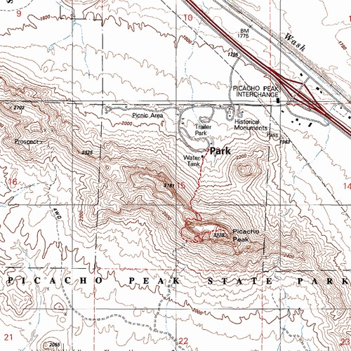
To find the trailhead, leave I-10 at Exit 219 between Tucson and Casa Grande. Enter Picacho Peak State Park just south of the interstate (a $7 per vehicle fee is required). Past the entrance station, turn left (south) onto the Barrett Loop road and drive to the trailhead parking area.
The trail quickly steepens as it climbs the lower flanks of the peak and then switchbacks onto a prominent saddle on a high ridge crest. It then plunges down the south side of the mountain before traversing to the base of the final climb towards the summit.
Season: Fall, winter and spring. This hike can be dangerously hot in late spring, summer, and early fall.
Water: None, bring plenty of your own.
Difficulty: Though not very long, this is a demanding hike. The 1,800 elevation gain in the four mile round trip walk leaves many short of breath. The steel cables ease the way through many steep cliffs, but some will find the exposure and steepness intimidating.
Maps: USGS Newman Peak, AZ or National Geographic Arizona digital map software.

Click map for larger image
This is a great hike in any time but the summer. You can still do it in summer but it requires a lot more preparation and water. Don’t go in the afternoon in July and expect to have a great time. It is a great place to go and will be missed when they close. As will the other 20 State Parks that are closing. Hopefully the people responsible for spending our tax money listen to what the people who elected them are asking for.
Did this hike last year and loved it! Someone recommended to bring gardening gloves for this hike (for the cables) and they worked perfectly. I am sad to see the park (and others) closing. Our many parks and recreation areas are what draw so many of us to love this state.
Went today and I loved it!!